
|Articles|November 14, 2016
Examining Fluctuations in Population Size and Movement Yields Better Vaccination Coverage
Author(s)Laurie Saloman
Satellite images of nighttime lights can improve vaccination coverage in shifting populations.
Advertisement
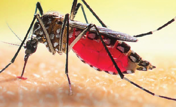
Although vaccination campaigns among low-income populations enable a higher level of coverage, too often coverage goals are not fully met due to uncertainties in population size and exact location. Short-term fluctuations, such as those that occur in migrant communities, mean population estimates may be significantly inaccurate.
In a recent
The problem was that in Niger, as in other countries, families who normally perform agricultural labor in rural areas often migrate to more urban areas during the dry season in a bid to find paying work. Therefore, the vaccination campaign underestimated the number of people in Niamey at that time, leading to fewer children receiving their measles vaccination than the campaigners had counted on.
The Penn State study team obtained satellite images of nighttime lights in Niamey during the time of the measles outbreak in order to determine exactly where a shifting population was located. Based on these images, the team came up with an estimate of how many children would have been vaccinated against measles given the number of vaccinations known to have been administered along with the locations in which they were administered, and it arrived at a coverage estimate of 51%; this percentage is significantly closer to the 50.5% coverage that the region experienced than to the vaccine campaigners’ initial estimate of 57% coverage.
Could the use of satellite imagery be adopted worldwide to ensure that populations everywhere are adequately vaccinated? “The concept of thinking about populations as fluid and dynamic looks a little different in the US than it does in agricultural Africa, but is still an extremely valid and important concept,” said Nita Bharti, PhD, an assistant professor at Penn State and one of the study’s authors. “Dealing with populations as static entities has repeatedly led to failures and missed opportunities for health care and disease prevention. So I think there is a lot of value to understanding the mobility of populations and using it to our advantage in health improvement in the U.S, but with some adjustments for what movement might look like [here].”
Dr. Bharti pointed out that the specific methods she and her team used in this study are not particularly applicable to urban settings in high-income nations such as the United States, because these areas are normally quite bright and would not reveal the presence of any additional people. “Increased brightness is not detectable in saturated pixels,” she said. “However, increased spatial extend (sprawl or expansion) is detectable.” So, it’s conceivable, then, that utilizing available data on likely residents in areas with bright lights—or “lit patches” as she terms them—might offer an opportunity to identify gaps in vaccine coverage and close them by offering vaccinations as early as possible in the event of an outbreak.
Advertisement
Related Content
Advertisement


Advertisement
Advertisement
Trending on Contagion Live
1
Once-Weekly Islatravir/Lenacapavir Meets Phase 3 Primary End Point
2
FDA Authorizes First Multiplex PCR Assay for HSV, VZV, and Mpox Skin Lesions
3
The Latest on the Cyclosporiasis Outbreak: An FDA False Positive Test, and What Treatment Looks Like
4
Cyclosporiasis Case Count Tops 7000 as Lettuce Probe Continues
5